– How long do you think it will take to go to Per Karlsatind?, my friend’s boyfriend asked me as I came to pick up my friend in Bodø city for our new adventurous hike to Per Karlsatind.
– I read somewhere that the whole hike should take about 4 hours, I answered.
My friend on the other hand had read that it took a day. We had both packed enough food for a day, but still decided to drive to a store and buy a 500 g milk chocolate bar just in case.
We started our hike from a small parking lot at Mølnbukta, about 40 km from Bodø city. There are no signs pointing to or at the parking lot itself, but on the left side there is a small sign which says that it is about 3,7 km to Per Karlsatind.
The trail was pretty steep for being in the forest, so It did not take long before we had something nice to look at.
It was a pretty hot day, hotter that I had thought it would be, and I was worried that I hadn’t brought enough water. It was therefore really handy that our track went alongside a brook.
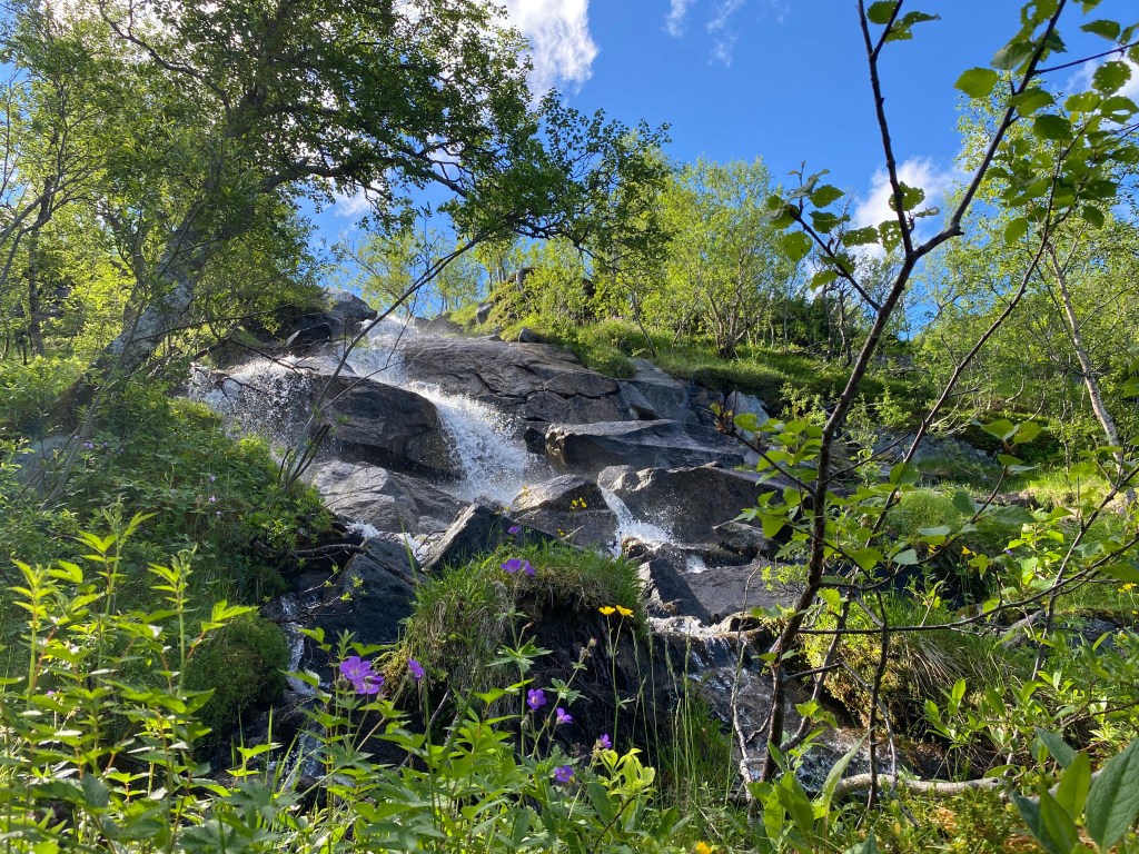
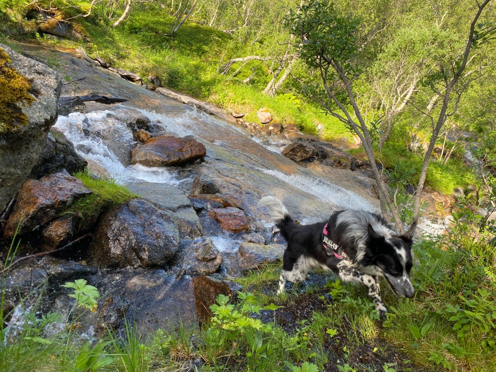
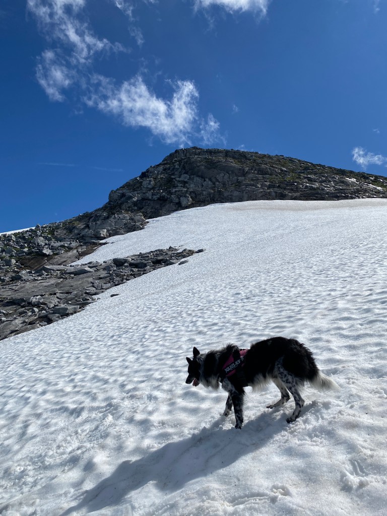
My friend’s dog, Chilli, was happy especially happy to cool down with some water.
My friend had looked at the Norwegian hiking app “UT” and found that this hike was in the category “demanding”. We couldn’t really see that that was the case from where we were.
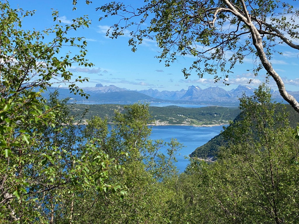
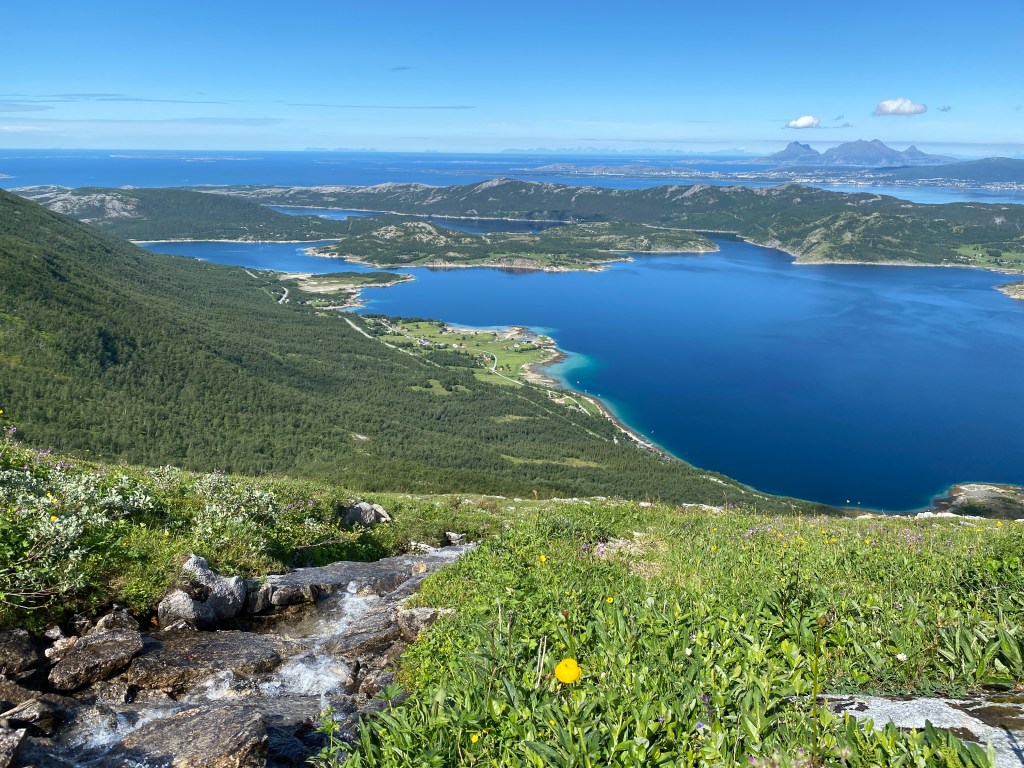
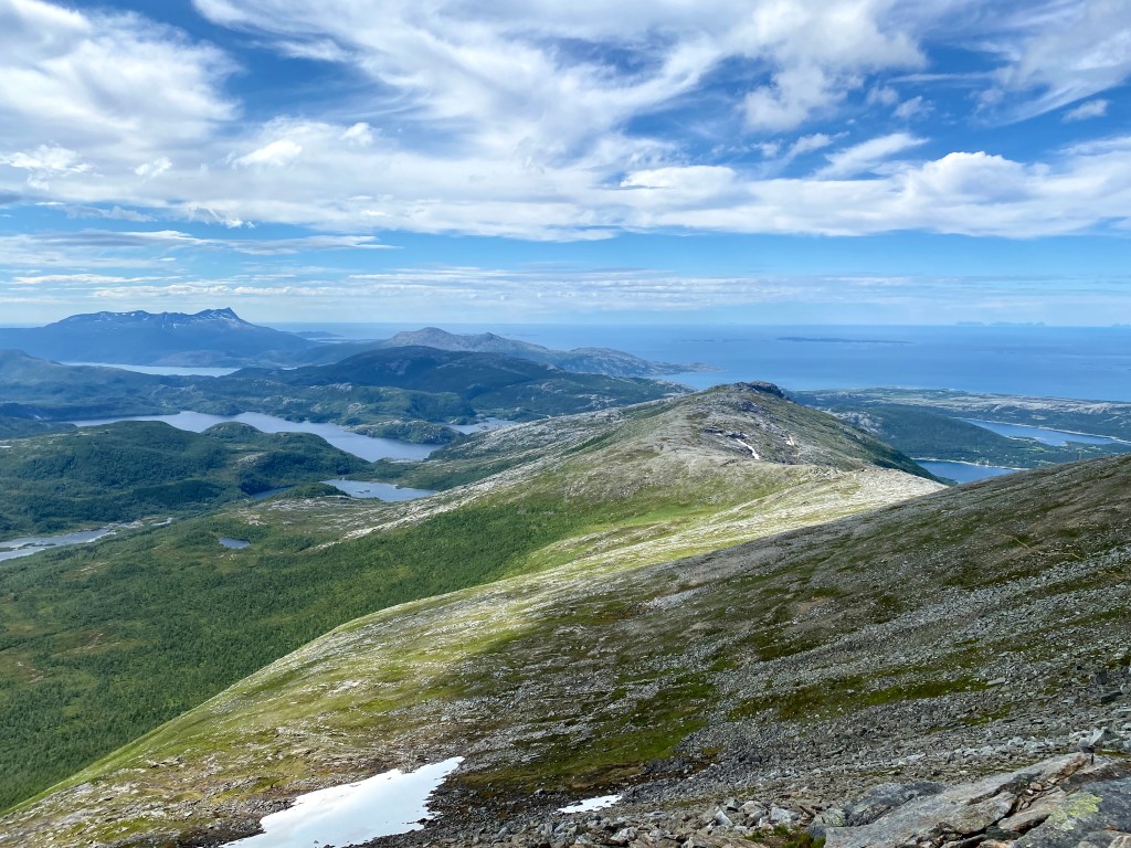
After about an hours walk, we decided to have our lunch with this view, which looked like a piece of art, in front of us:

– This is why we live in Bodø, my friend said.
And I couldn’t agree more. If you look closely on the picture, you can see Lofoten islands in the horizon to the left.
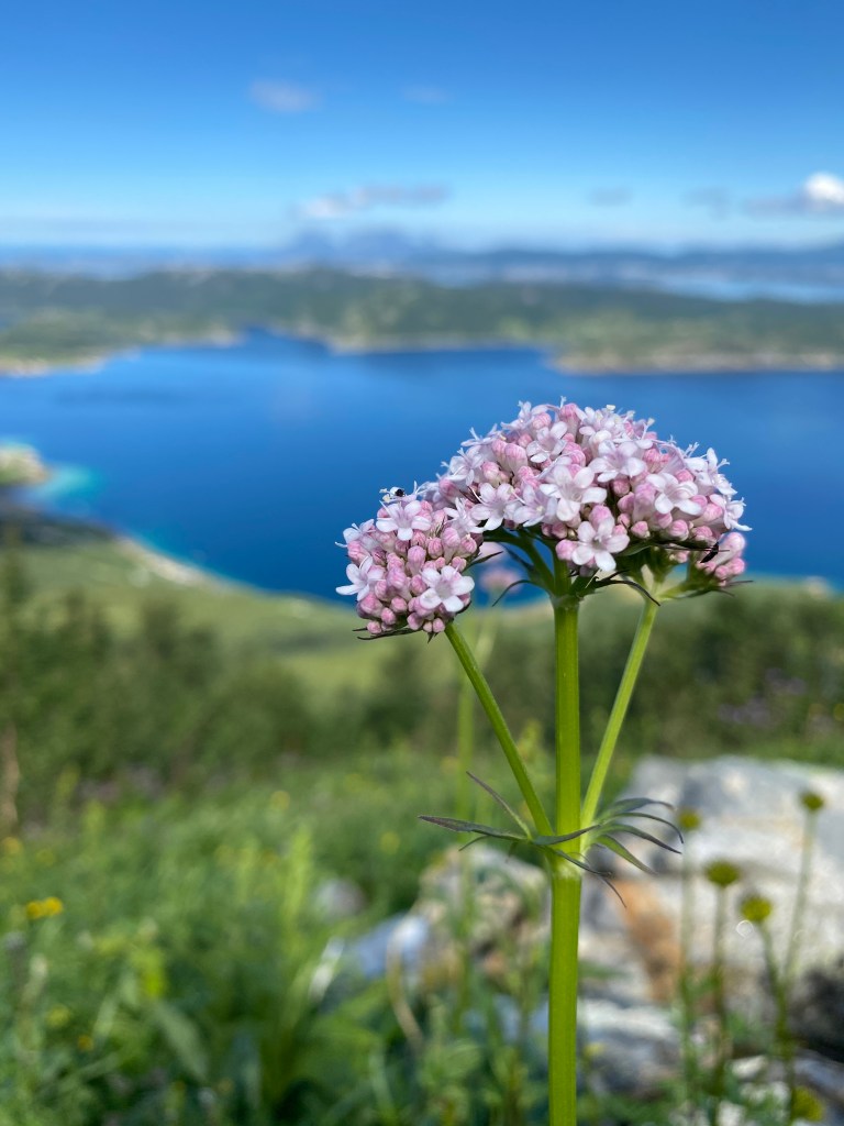
We saw lots of flowers on our way to the top, but I didn’t want to stop too often, as we still didn’t know how long the hike would take us. We thought that it was really easy to follow the track, so even though the track was not marked, we were not afraid to get lost.
We also met other people on our way that we could ask. The stream was still close to the track, so we were able to fill our water bottles many time. It was clearly not enough with the 500 ml of water I had brought with me on a hot day.
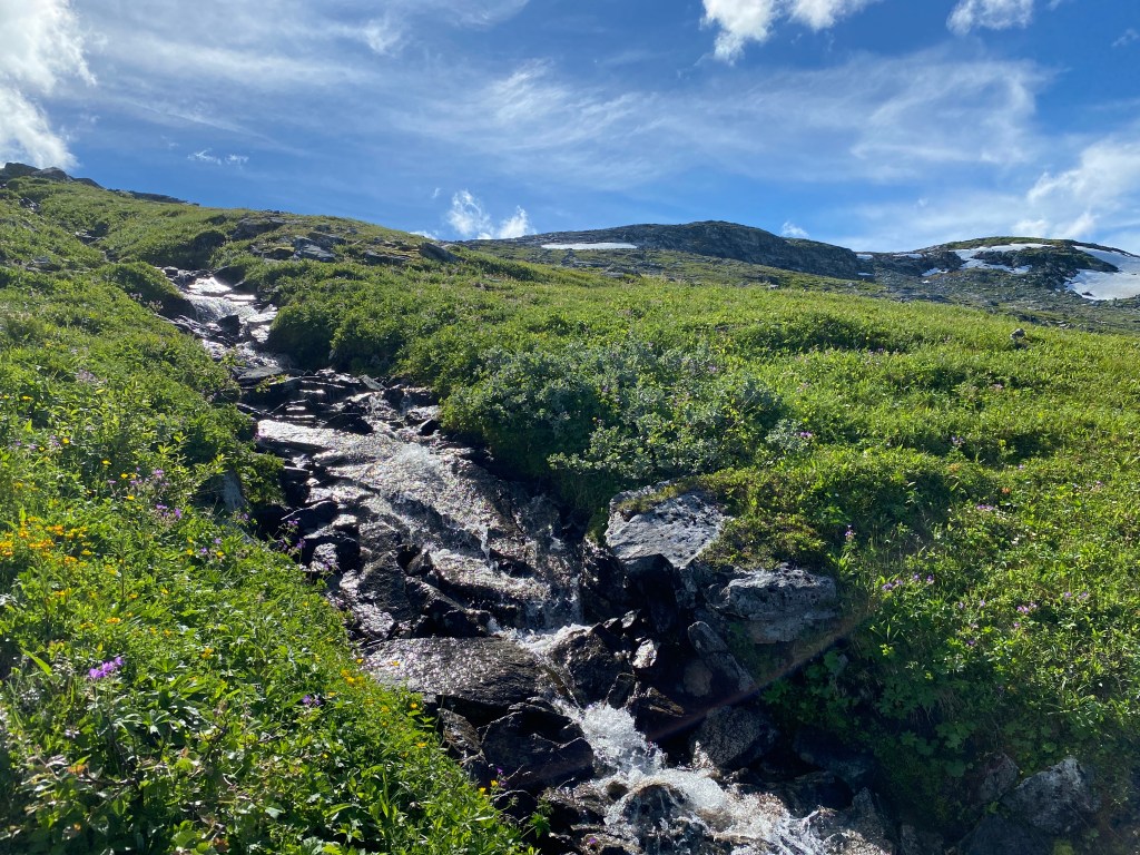

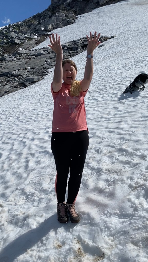
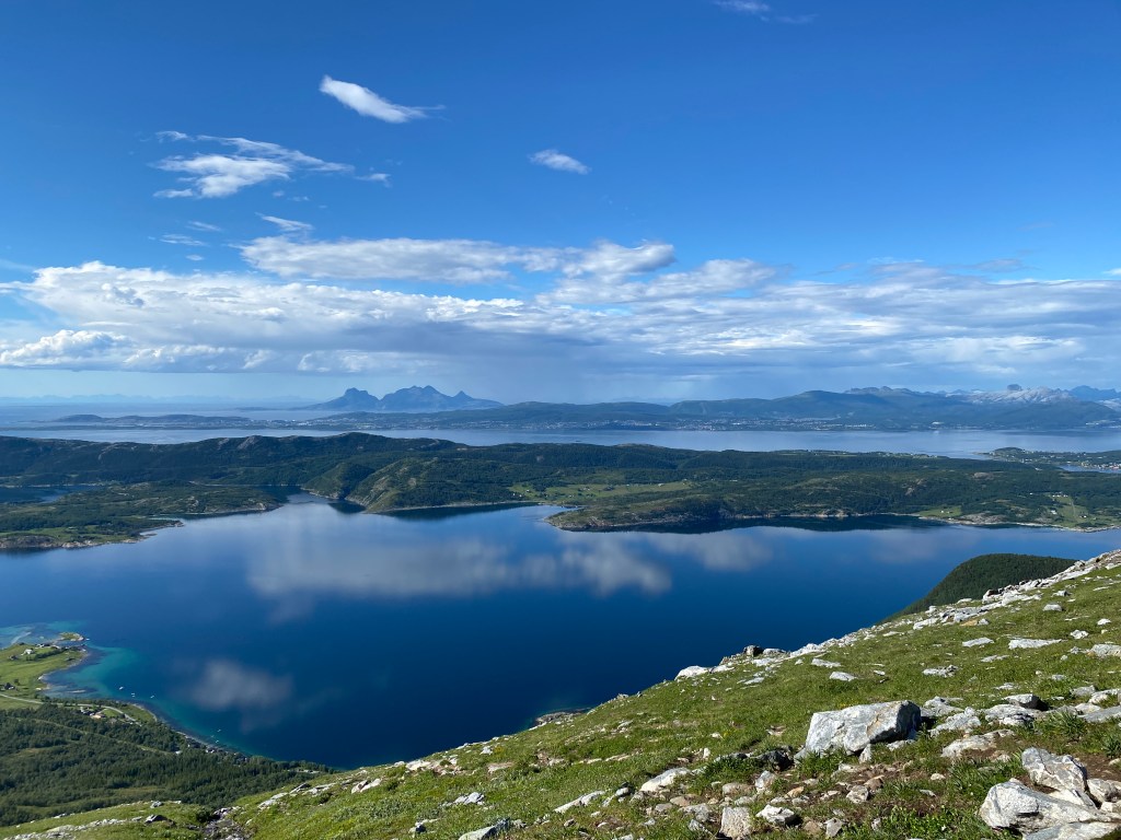
As one of the pictures above shows, there is still some snow left in the mountains, even though we are in the middle of the summer. We were actually thinking about going on this hike in May, but it was too much snow and therefore not safe to go there for us (we are not the most experienced hikers). Now, we looked at the little snow that was left in a positive way- a way of cooling us down. Our own freezer.

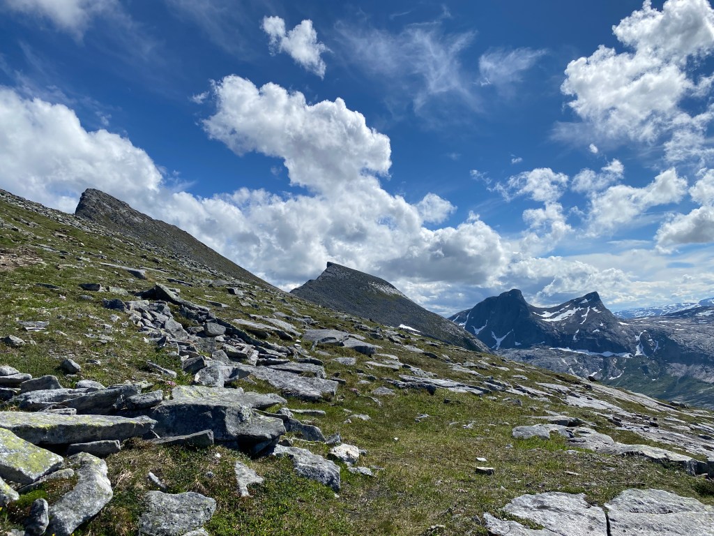
At some point we though that the mountain top over the snowfield was Per Karlsatind. But it turned out that it wasn’t. There were still a long way to go. About 45 minutes after our snow bath, we were able to see the mountains on the other side of the ridge.

And when we turned around the corner, it was a special feeling to be behind the peaks that I can see from my flat. We were soo excited.
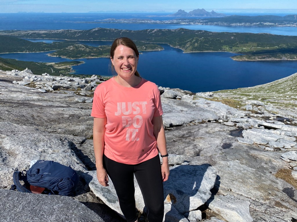
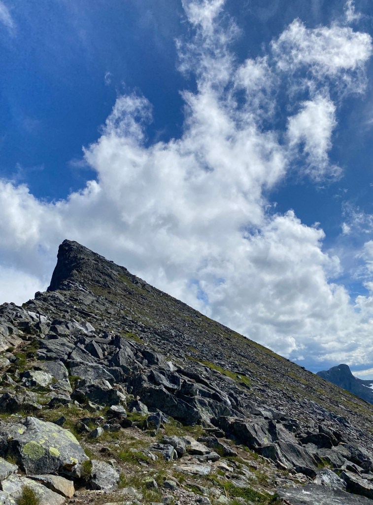
After some more walking, we found ourselves at the place where we had seen so many pictures from when doing our research for the hike, the Legdknubben peak.


Just a few years ago I would be too scared to stand here, but now, I could actually enjoy it. I had to have my water break a little bit away from the cliff, just in case.
From the distance it seemed impossible to climb Per Karlsatind, but as we got closer we could see that it was not as steep as we thought.
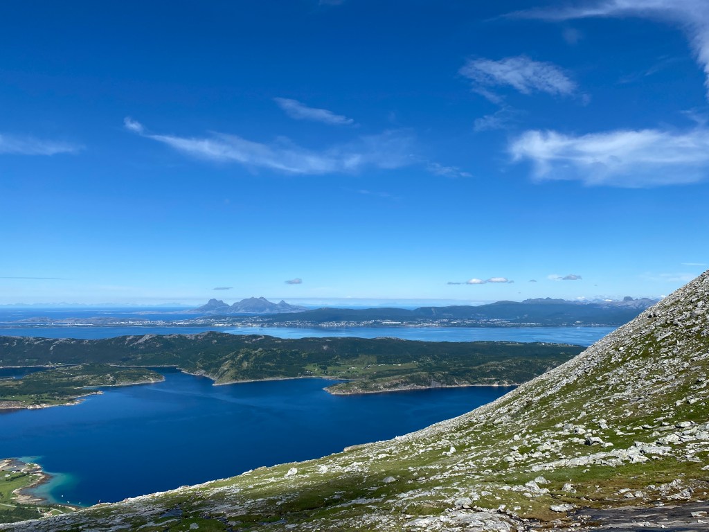
The 1036 m mountain peak got its name after the Sami reindeer herder Per Gustav Karlson, also known as Per Kalsa, who in the 19th century found some lost sheep close to the peak, and had to create a skiing track to get them down from there (described in the book “Trekking in Bodø” by Bodø Trekking Association). The peak is a part of Børvasstindan mountain range, which you can see from most places in Bodø.
As we started walking towards the peak after our break, we met some ladies who said that they thought that they had heard thunder in the distance. If there is one place you dont’t want to be during lightning and thunder it is on top of a peak. Therefore, we decided to walk as fast as we could, to try to reach it before the bad weather arrived. It turned out that it was not our smartest move to speed up at the steepest part of our hike. After walking for about 15 minutes, I suddenly felt really dizzy. I am not sure if it was my fear of heights that had come back, dehydration, too much sun or the fear of being struck by lightning that led to my dizziness. Either way, we had to stop.
I sat down and suddenly got the feeling that I could faint and fall down at any time. While clenching on to a rock I struggled with deciding whether I should close my eyes or take in the view.
– You need to drink water. And please, have some chocolate, my friend said, throwing the chocolate bar towards me, trying to avoid that the dog got hold of it.
I actually felt a bit better after having some chocolate and water. I have experienced earlier that when I distract myself by taking photos, mye fear of height is reduced. So I took some pictures of the spectacular view:


And this is me, taking a selfie, trying to put on a brave face, still sitting down as I was to scared to stand up:

Heavy rain clouds were heading our way, so we decided that we ended our peak climbing here. At least we were on the peak, just not on top of it.
So we started or journey back to the starting point. After we had walked for about 15 minutes, we met a couple who asked us how ar it would take to get to the top of the peak. They had been told that it only took about 15 minutes to the peak from the last people they had met, but they had already been walking for 15 minutes. I guess it is difficult to know how far thing takes in the mountains.
The rain clouds had caught up on us, and soft rain drops landed on us. I managed to put on a waterproof jacket and waterproof trousers before it started raining more heavily.
On the other side of the mountain, two rainbows appeared in front of us.
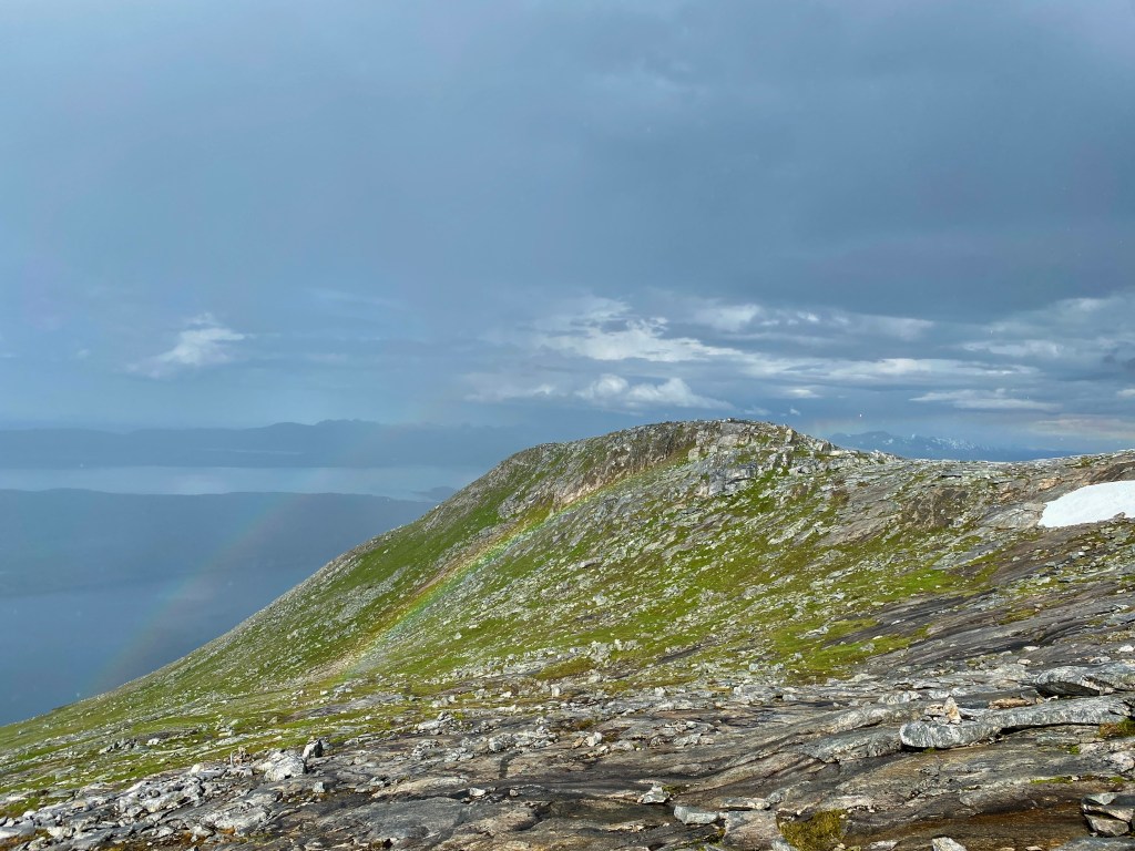
The rain felt refreshing. The downside was that the ground became pretty slippery. Suddenly we discovered that we were off the track, and we were surrounded by slippery stones.
Then I remembered that there at some places near the track, there had been some tall stones, which we had been unsure of whether it was put there on purpose as a mark, or if it was a coincidence. Now, I could spot one of them, which guided us back to the track. It felt like I found the Norwegian version of Craigh na Dun.

And then, as if nothing had happened, the rain clouds disappeared.
After a lot more walking, we were finally back to our starting point, the parking lot at Mølnbukta. I looked at my mobile phone to see how many hours we had used all together. It turned out that it had taken us 8 hours. In spite of some struggles, we had had an amazing hike to one of Bodøs most spectacular places, and we were already planning our next hike.

One thought on “A spectacular hike to Per Karlsatind”