Postcard-like midnight sun scenery, sandy beaches and wild nature. Værøy is a small pearl in the ocean waiting to be discovered.
Visiting Værøy has been on my bucket list for a while. It was actually one of my friends who had Værøy on her bucket list first, but I was not difficult to convince. Last weekend we decided to put our dream into action.
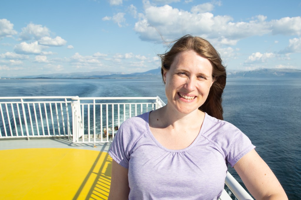
Værøy is an island that belong to the Lofoten islands. It is actually just a 5 1/2 hours ferry ride from Bodø, but as I get really, really seasick in bad weather, we had to wait untill the weather was good enough. We decided to take the ferry straight after my friend had finished work. We booked our tickets in advance, just in case there were many people like us who aimed for Lofoten. The ferry ride is actually free, as the government recently decided to sponsor it fully.
After a few hours the ferry stopped at Røst, which also belongs to Lofoten. Visiting Røst is also on my bucket list, so it was great to have a sneak peak of the centre of the municipality, which consists of 365 islands, from the ferry.

The ferry crew had directed some of the cars in the ferry wrong back in Bodø, so I think we spent 30 minutes extra at Røst while this was sorted out. Luckily my car was located on the right place, so could continue to be a photographing tourist on the deck.

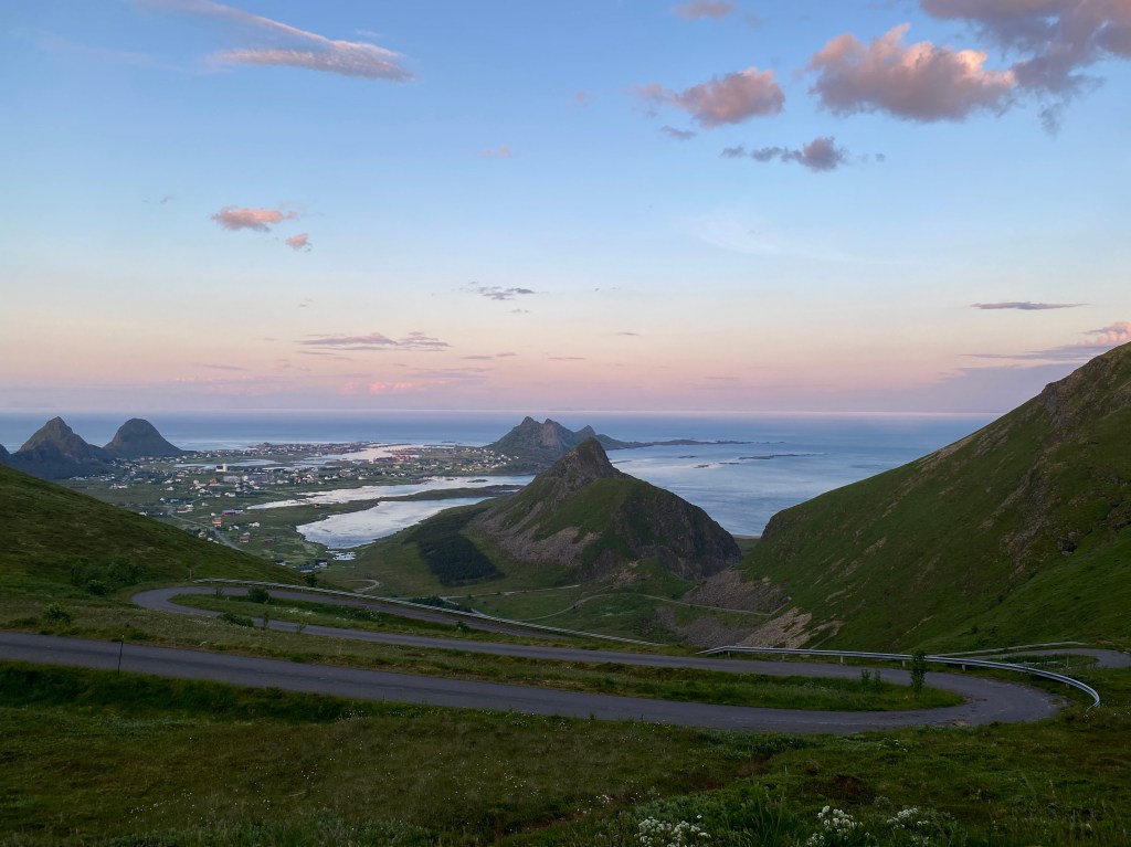
We arrived Væræy at about 11 pm. We decided to start our stay in Værøy with a hike in the midnight sun. Our hiking goal was Håheia, as we had heard that the view from the top of the 431 meters high peak was really nice. The hike, a 5 km round trip, started just a few minutes drive from the ferry. We parked at a parking lot called Håen Parkering (you can find it in Google Maps). As we got out of the car, an unexpected freezing, strong wind hit us. Luckily we had brought a lot of warm clothes with us, but we were unsure how bad the wind would be on the top. We decided that we did not want to postpone the hike until the day after, so we put on some clothes and started walking.
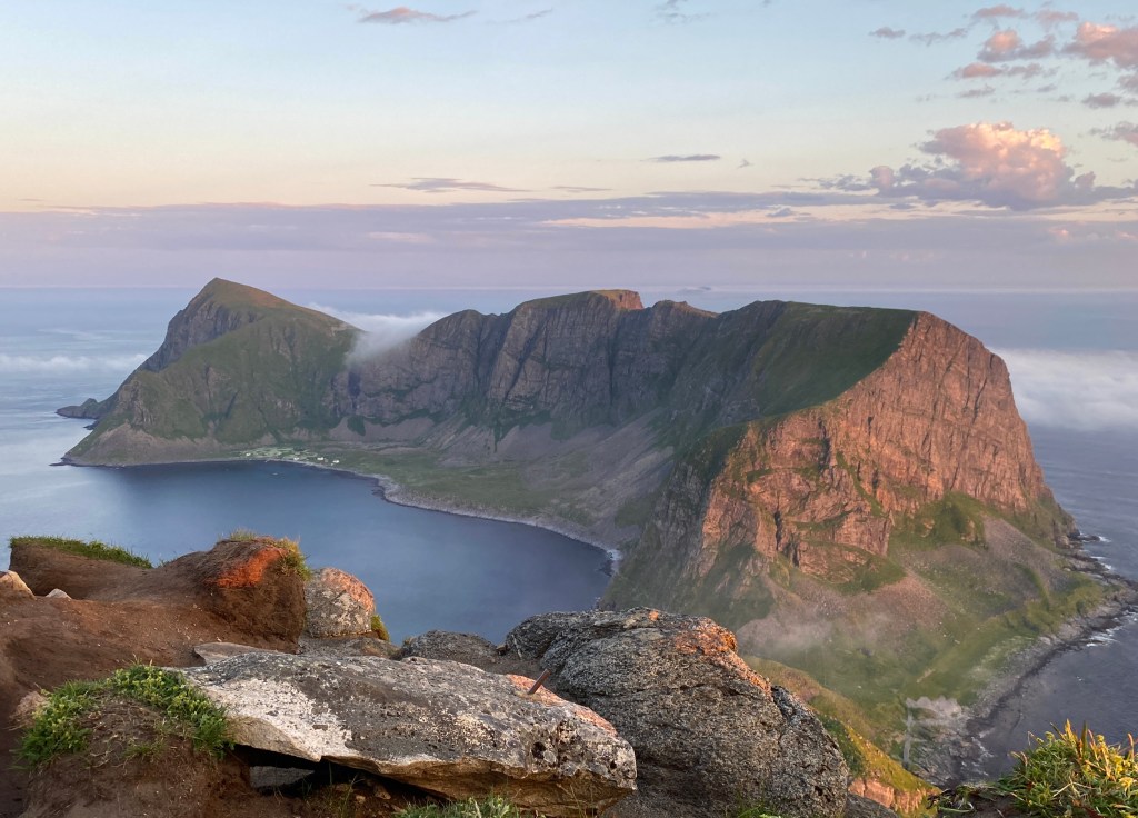
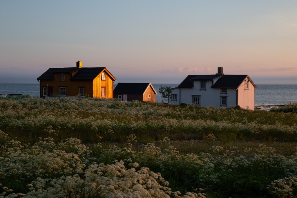
An old coast radar is located on the top of the Håheia peak. We could choose if we wanted to follow an old road called the “NATO road” which goes straight to the coast radar or follow a track. At the beginning of the NATO road there is an old, dark tunnel, which I had read somewhere that it was not recommended to use, so we decided to follow the track. The track started by the parking lot, close to the blue buildings in this picture:

Due to the strong wind, and the fact that our feet felt a bit stiff after a hike before the Værøy tour, we decided to continue with following the road. It felt so much easier to walk on the road, rather than the steep track, though we took some short cuts.
Surprisingly we found a sign that said that the in the old days some locations on the peak were used by locals to catch eagles, which they caught and killed by only their hands. They did it to stop the eagles to kill their sheep. The eagles are now protected, so fortunately this is not something that people do anymore.
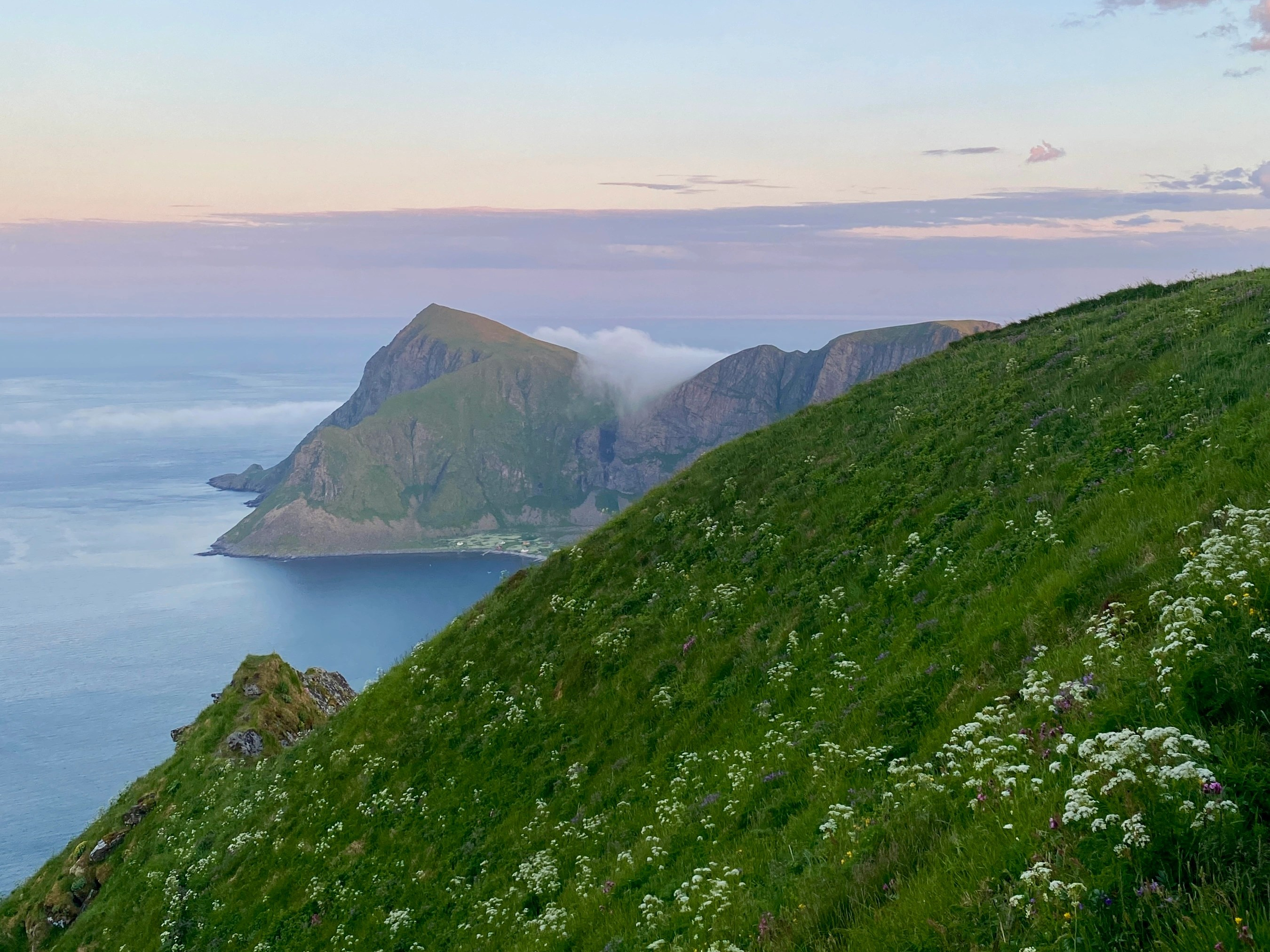
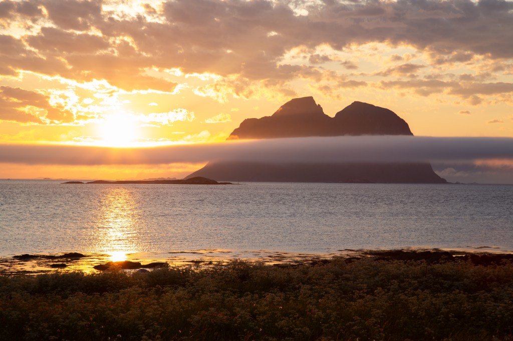
The midnight sun decided to show itself from its best side, and withe a mysterious fog played with the other Lofoten islands in the background, the view was really breathtaking.

It was actually not as dark outside as it looks like in these pictures. It was closer to this:
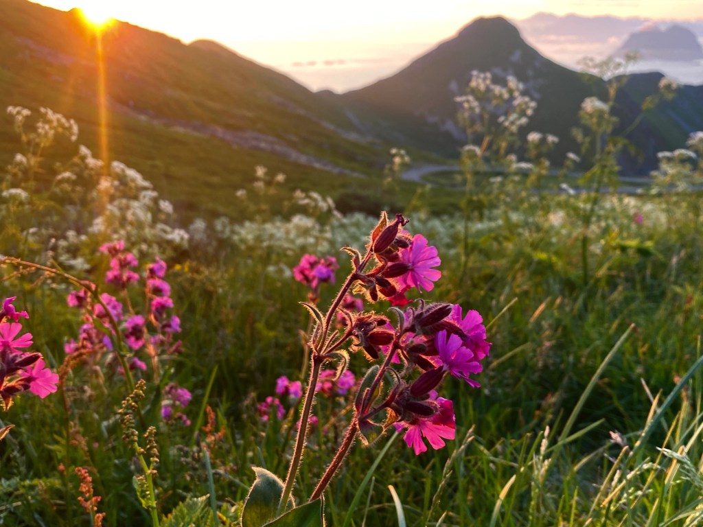
The green landscape reminded be a bit of Scotland.

We were not sure if we were allowed to take a photo of the coast radar, so we just walked past it. And then we finally entered our destination.
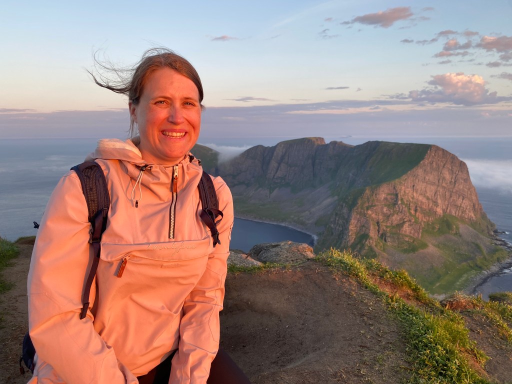
If I seem uncomfortable on the pictures, it was just because it was a little bit scary to stand close to the edge. My face is read because I am facing the midnight sun. I have actually read that some tourists think that we have to suns in the North, as if it was a big lamp that we could just turn on or off.
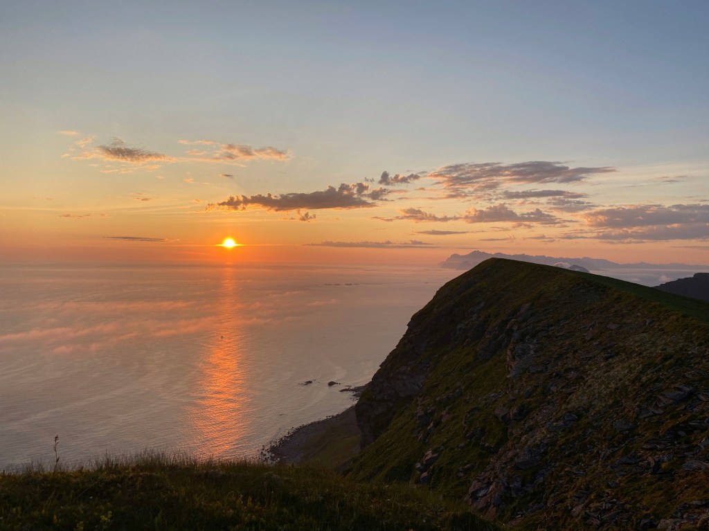
We went back to the coast radar, and turned to the left, to look at the view from there. And it looked just like the ads that you see from Lofoten, with the sun mirroring itself in the water.
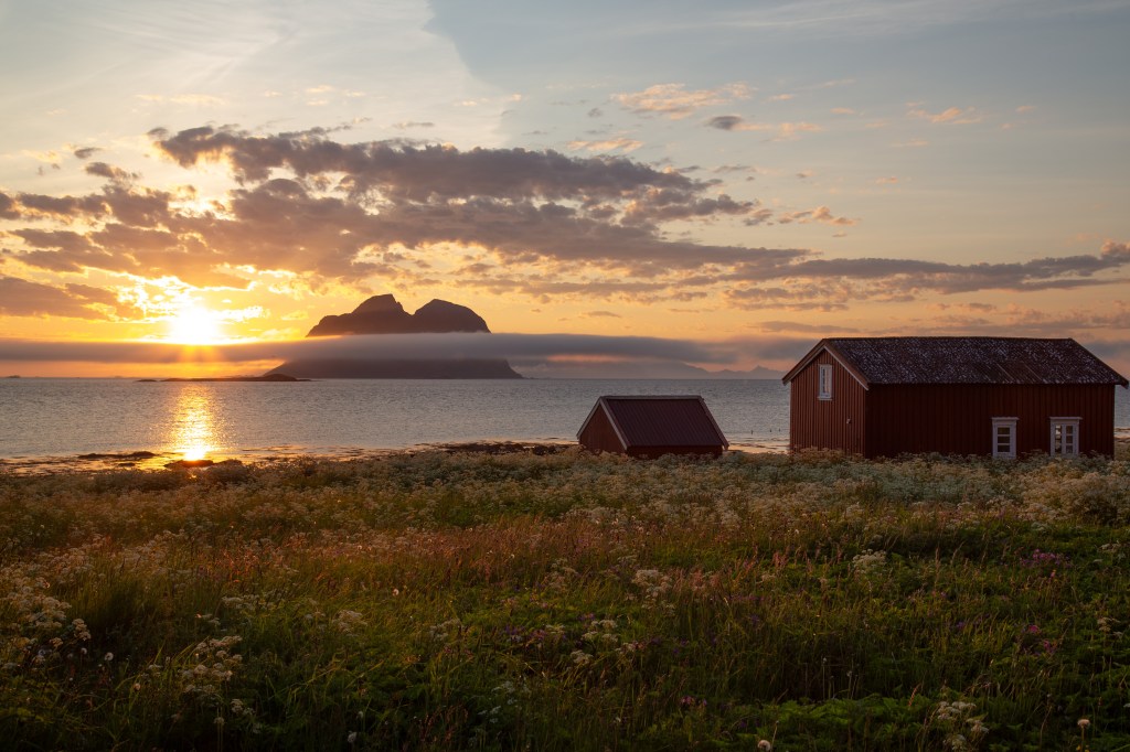
We were really happy that we decided to visit the peak in the middle of the night. Another benefit was that there were no traffic on the road. On our way to Nordlandshagen, where we were going to spend the night, we had to stop the car so I could take some more photos.
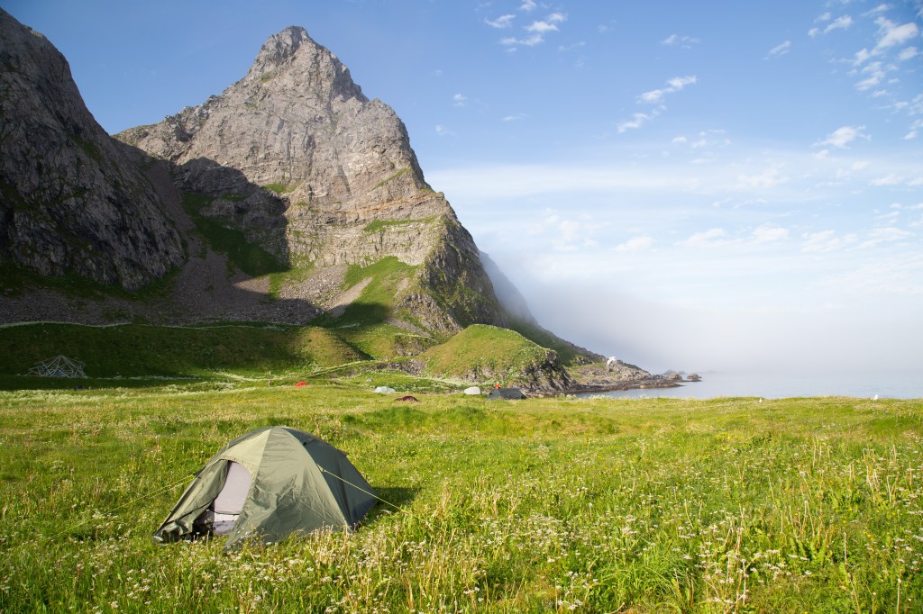
I managed to take the wrong road towards Nordlandshagen, and we suddenly found ourselves on an old airport, which is now used by caravans and motorhomes. We followed a gravel road until it stopped. Here we found a house with three toilets, and a lot of free space to put up our tent. There were some other campers there, so we tried to put up the tent as quiet as possible. This is how the place looked like in the morning:

As I woke early I decided to do some exploring before breakfast. Down by some rocks, an eagle sat quietly. As I got closed, it flew away. Maybe it thought that I was going to kill it. But my camera shots certainly will not kill anything.
I had not noticed the beach when we arrived at Nordlandshagen in the middle of the night. What a place!

Even though it can be nice to have a place like this all to oneself, I was glad that there were other people there. Especially since I forgot to bring matches for the trail stove, and we got to borrow some from a Swedish family.
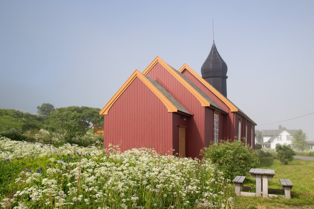
After our breakfast it was time to hit the road again. We drove past this old church:
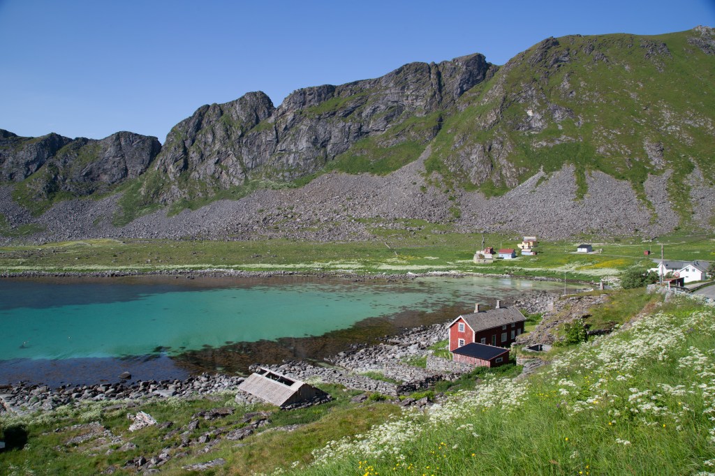
And this idyllic place, with beautiful, turquoise water:

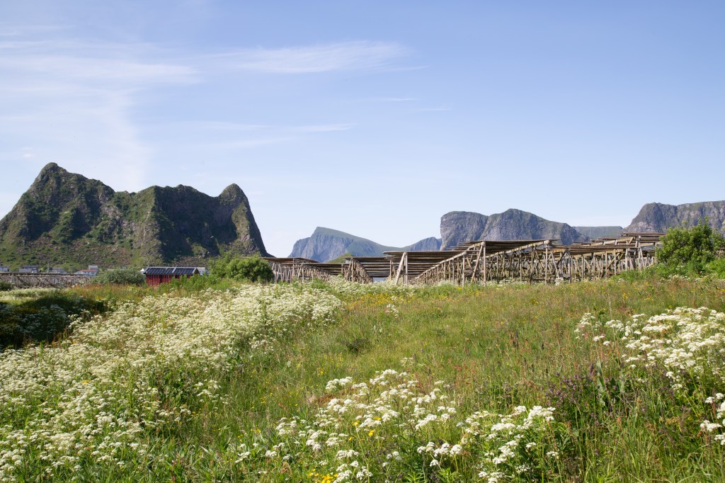
I had read about a newly renovated old trading post from the 19th century that I wanted to visit. After a quick stop at the local grocery store we headed towards Røssnessvågen, where the trading post was located. With only 678 residents and some tourists, there were not a lot of traffic on the road. But we had to stop when a tractor filled with dry fish heads stopped in front of us. It turned out that the driver had lost some of the fish heads and had to return to pick them up. Dry fish heads is actually a delicacy in Nigeria, and are exported from Verøy to Nigeria. Dry fish, without the heads, are a delicacy here in Northern Norway. Here you can see some of the drying racks they use to dry the fish:
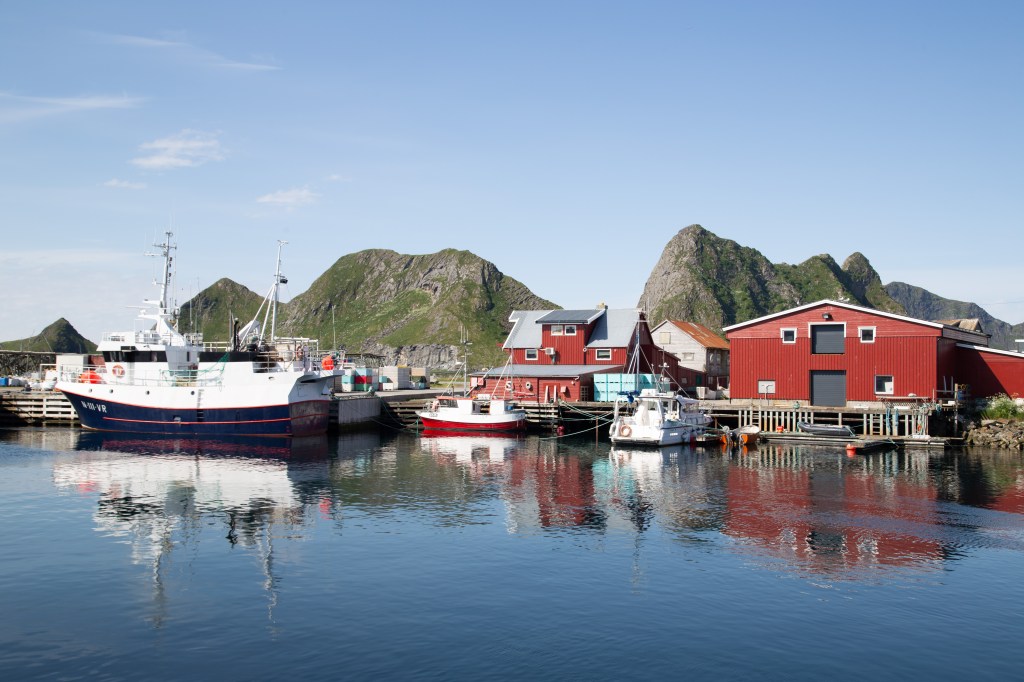
And then we entered the old trading post, were we amongst other saw these buildings:


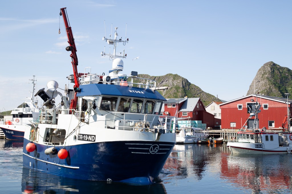
Unfortunately everything was closed. The old trading post was located in the middle of an active fishing village, so we also got to experience fishing boats arriving and fishermen talking loudly to each other on the quay. Maybe theyt were trying to decide who had caught the biggest fish?

As we had to catch the ferry back to Bodø at noon ( the only ferry that heading for Bodø that day), that was all we had the time to see in Verøy this time. But I felt like we had experienced a lot in our short stay at this pearl of a place.

